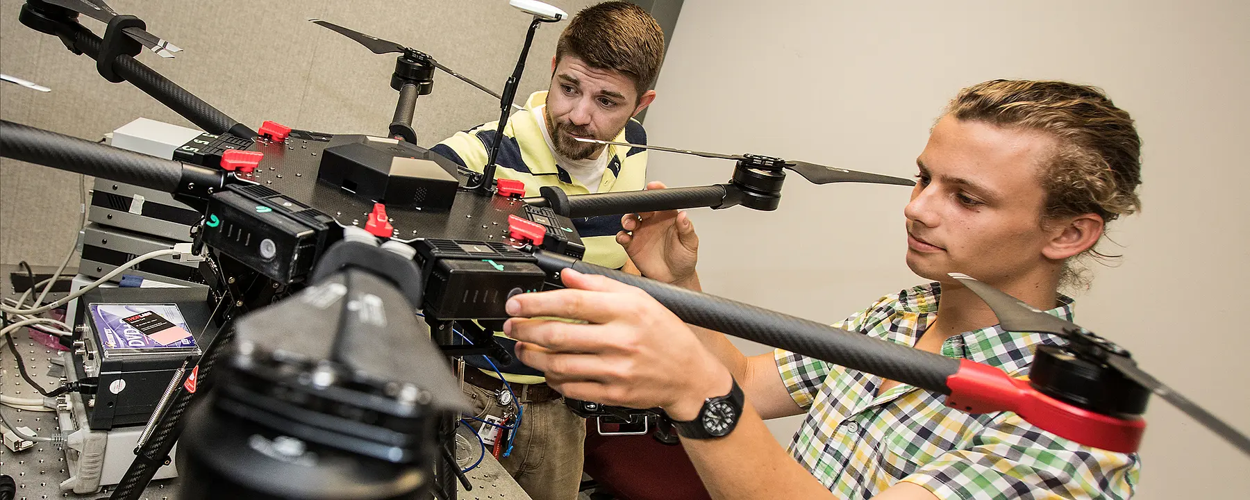
Linking sensors to drones to reduce the cost and expand the possibilities of data collection
As business and government increasingly rely on data, one of the roles of science is to create innovative methods for data collection and analysis. The hunger for data has grown along with the complexity of problems facing society—problems whose solutions will require linking diverse technologies that go beyond human senses and abilities.
Under an independently funded effort, a team of our experts from several disciplines is working together to build new data collection tools that combine the diverse capabilities of sensors with the versatility of unmanned aircraft in the service of science. We call this sensor implementation and integration project our Advanced Smart Sensor Technology, or ASSET.
Integrating and Testing a SWIR Sensor on a Commercial Drone
We have developed a novel imaging sensor that is sensitive to the visual and short-wave infrared (SWIR) portion of the optical spectrum. Compared with other sensors of this kind, the low cost of our technology makes implementation on small commercial drones practical. As part of the ASSET project, we integrated a camera outfitted with our sensor onto a commercial hexacopter drone for the first time, and obtained aerial images that contain information about the SWIR signature of the terrain, its plant life and objects. These images and data are of value in agriculture, forestry, pollution control, public health and safety, survey research, and other commercial and scientific applications.
We continue to develop and test the ASSET sensor in a variety of drone-enabled scenarios, including
- Controlling the spread of mosquito-borne viruses by identifying containers of standing water that could serve as breeding sites
- Developing more accurate predictions of food crop yields through advanced phenotyping of plants during their growing cycles
- Aiding search and rescue operations by providing situational awareness under limited visibility conditions.
Drones equipped with advanced sensors can be used by the world’s most technically sophisticated companies and researchers, and they can also can be invaluable in low-resource environments. Users can “leapfrog” over the limits of existing infrastructure, as many developing countries have done by adopting mobile phones and Wi-Fi in lieu of wired telephone and internet lines.
Gaining Access to New Sources of Data and Solving Challenges in Real-Time Data Processing
We are only beginning to explore the potential of this exciting new combination of technologies. Because SWIR sensors can detect water, either on its own or within plants, they can be especially useful in agriculture. With a drone, farmers can survey their fields much more quickly than on foot, finding areas where crops need more water even if they’re hard to access. This information enables real-time decisions about irrigation and fertilization. Combined with predictive models, these data can also contribute to yield estimates.
Other potential uses include using SWIR to see through smoke and smog, or to check for leaks in pipelines, power plants, and other large infrastructure projects where size, access, and weather conditions make it difficult for people to collect samples. With the ability to detect substances such as water, nitrogen, lignin, carbon dioxide, and methane, our SWIR technology can contribute to forestry, ecosystem analysis, fire management, and pollution control.
Gleaning insights from data also requires advanced skills. We can assist our clients in the analysis phase as well. As one of the world’s leading research institutes, we are able to draw on decades of work in statistics, data science, survey design, software development, and predictive modeling in dozens of scientific fields. In a later phase of the ASSET project, we plan to integrate real-time data processing using cloud technologies. Analysis closes the circle that begins with ASSET data collection, allowing our clients to take action based on what they have learned.
Early uses of the low-cost SWIR sensor on drones will pave the way to more research. By combining the latest technology with the ingenuity of our researchers in social sciences, survey research, environmental science, and other areas, we will discover new applications to address the needs of our clients and advance the field of sensor R&D.
- RTI-funded

