Impact
Objective
To help Wake County, North Carolina, evaluate future water resource risks and compare management strategies as part of a comprehensive One Water Plan. The One Water Plan is a 50-year effort designed to integrate drinking water, stormwater, wastewater, and groundwater resources.
Approach
RTI provided watershed modeling and scenario analysis using RTI's Watershed Flow and ALLocation (WaterFALL® ) modeling framework to assess current watershed conditions, develop future-condition scenarios, and quantify the potential impacts of alternative management approaches. The analysis examined future land-use change and climate conditions, generated catchment- and subbasin-scale results, and evaluated strategies aligned with Wake County's One Water planning objectives.
Impact
RTI's modeling helped Wake County translate broad One Water goals into measurable planning information that could support prioritization and investment decisions. By evaluating future outcomes before implementation, Wake County gained a stronger technical foundation for comparing alternatives, focusing resources, and advancing long-term water resilience with greater confidence.
Planning for Future Risk on a Watershed Basis
As one of North Carolina's fastest-growing regions, Wake County needed a science-based solution to understand how population growth, changing land use, and climate variability could affect surface water supply, groundwater resources, and water quality. These pressures create complex challenges for maintaining water supply reliability, managing stormwater and waterwaste, protecting groundwater resources, reducing flood risks, and improving water quality. Through its One Water Plan, the county sought to bring these interconnected issues into a single long-term planning framework.
RTI's role was to help make that planning framework actionable. Using WaterFALL, RTI evaluated how future land-use and climate scenarios could influence both water quantity and water quality across the county's waterbodies, as well as recharge to the deeper groundwater aquifer that serves many well owners. The work produced spatially detailed results that showed where future impacts may be the largest and where management actions may be most effective.
Hydrologic Modeling, Watershed Simulation, and Scenario Analysis
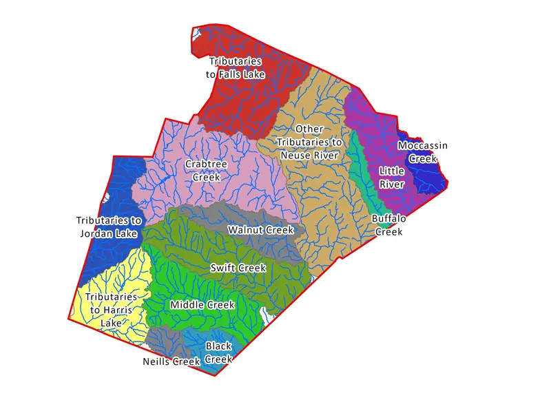
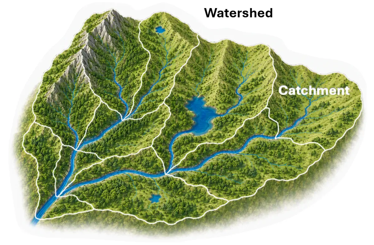
A distinguishing feature of the work was its catchment-scale analysis, where a catchment is the area of land that contributes runoff to an individual stream reach. Instead of relying only on countywide averages, RTI generated information at the catchment level, averaging about 0.5 square miles across approximately 2,000 catchments in the county, and summarized it to subbasin and county scales. This gave planners a clearer view of geographic variation, helping them identify vulnerable watersheds, compare relative risks, and focus attention on places where investment could produce the greatest value.
The future-condition assessments were designed to help Wake County anticipate both human-driven and climate-related challenges. RTI incorporated customized land cover change maps and integrated downscaled climate projections into WaterFALL to evaluate how the county's growth plan and changing climate conditions could affect watershed performance. This allowed the county to look ahead at potential changes in hydrology, water quality, and groundwater recharge rather than relying only on historical conditions or reacting after problems emerge.
The analysis considered how future conditions could influence water quantity and quality across the land surface, within the subsurface, and through on- and off-stream waterbodies and rivers. By evaluating these interconnected outcomes together, RTI helped Wake County examine water resilience as a system rather than as separate drinking water, stormwater, wastewater, or groundwater issues. That systems view is central to One Water planning because decisions in one part of the watershed can affect conditions elsewhere.
RTI's watershed simulation framework also created a practical bridge between technical analysis and planning decisions. Catchment-level outputs could be translated into subbasin- and county-scale summaries for communication, while still preserving the detail needed to identify local vulnerabilities and opportunities. This helped planners connect scientific results to questions such as where impacts may be largest, which watersheds may be most vulnerable, and where management actions may be most effective.
Water Management Tools That Support Defensible Decisions
The modeling also allowed Wake County to compare management strategies before implementation. Example strategy categories included water supply resilience approaches, green stormwater infrastructure practices, land conservation and preservation strategies, and flood resilience measures. By linking strategies to measurable outcomes such as runoff reductions, stormwater retention, mitigated groundwater recharge volumes, and nutrient and sediment loading reductions, RTI helped the county evaluate which pathways could best support long-term resilience.
For decision-makers, the value of this work was not simply the model output—it was the ability to move from evidence to direction: to understand what the data showed, what those findings meant for real water management choices, and how different strategies could be compared before implementation. That is where RTI's independence and technical depth become practical client benefits: analysis Wake County could use, act on, and defend.
The project reflects RTI's broader role as one partner across many disciplines. Long-term water resource planning does not fit neatly within a single domain. It requires hydrologic modeling, climate and land-use scenario analysis, environmental science, spatial analysis, and planning support working together. RTI integrated those capabilities to help Wake County connect One Water goals with the real-world decisions needed to strengthen future water resilience.
County Summary of Outcomes from the Targeted Green Stormwater Infrastructure (GSI) for Flood Resilience Strategy
| Modeled outcome | Countywide result | Why it matters |
|---|---|---|
| Implemented GSI capacity across bioretention, green roofs, and permeable pavement | 199 million gallons of installed capacity across 3 GSI types within developing lands | Evaluates the efficiency of different types of GSI that could be required during future development in reducing flood risks |
| Maximum daily reduced runoff benefit | 28.7 million gallons per day | An indicator of the mitigation effects of GSI on localized flooding during large storm events |
| Annual mean runoff reduction | 1,247 million gallons per year | Quantifies how much stormwater is kept out of the storm sewer systems, thereby reducing flood risk and making water available for irrigation use, baseflow supplementation, and groundwater recharge |
| Annual average reduction in sediment load transported out of the county through rivers | Over 17,900 tons per year | Demonstrates the large water quality co-benefits achieved from efforts focused on flood reduction |